The Satellites Are Watching Clinton County's Burn Pits
How free European satellite data, public parcel records, and a laptop became a county-wide monitor for illegal commercial waste burning
Twice a week, a pair of European Space Agency satellites passes over Clinton County and photographs every acre of it in wavelengths the human eye cannot see. In those invisible bands, freshly burned ground has a signature as distinctive as a fingerprint. As of this month, a locally built monitoring system is reading that signature automatically — across all 420 square miles of the county, every week, at a total operating cost of zero dollars.
The system, called BurnWatch, was built to address a specific and persistent problem in rural Missouri: illegal open burning of commercial waste. State regulation draws a clear line. A farmer burning brush from his own fence line is generally within his rights. A commercial operation — a tree service, a land-clearing contractor, a demolition crew — hauling customer debris to a pit and torching it is another matter entirely. Missouri's air rules (10 CSR 10-6.045) restrict the open burning of trade waste, and for good reason: these fires burn hotter, longer, and dirtier, they operate as unpermitted disposal businesses on land zoned for other uses, and their smoke becomes the neighbors' problem.
The enforcement difficulty has always been the same: nobody sees it happen. A burn pit on a back forty is invisible from the road, complaints are hard to substantiate, and by the time anyone official looks, the fire is out. What changed is that seeing it no longer requires being there.
How it works. Every new satellite pass is compared, pixel by pixel, against the previous clear view of the county. Where vegetation has been replaced by char and ash, the change registers mathematically — an index shift that burned ground produces and that ordinary farm work does not. The system then does what makes the data meaningful: it lays each detection over the county parcel map. Every flagged burn arrives with a location, a date window, an acreage, and the deeded owner of the ground under it.
Filtering does the rest. Whole-field agricultural burns — legal and common each spring — are screened out by their size and shape. What remains is scored: a site that burns once ranks low; a site that burns again and again ranks high; a compact repeated burn on a small parcel owned by a commercial entity, with no timber being cleared on that parcel to explain it, goes to the top of the list. That pattern — material arriving from somewhere else to be burned, repeatedly — is the signature of a disposal operation, not a landowner tidying up.
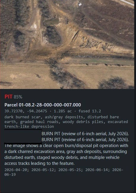
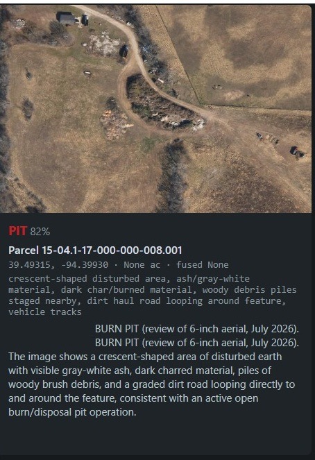
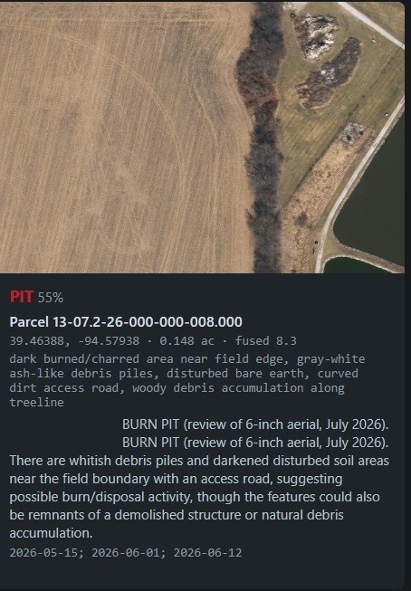
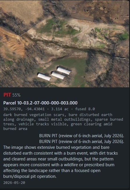
Proof it works. Before any result was trusted, the system was tested against ground truth: a known disposal trench — a crescent-shaped pit fed by truck and boom, ringed by its own graded haul road — whose location the software was never given. The satellite record independently documented the site's burning, including a major event in mid-May visible as unmistakable fresh char from orbit. The county-wide scan then found the site on its own, 200 feet from its surveyed center. And when the final stage examined the state's 6-inch aerial photography, it identified the feature as a burn pit and listed the evidence: the crescent scar, the ash, the staged wood, the haul road. The full county census that followed distilled 420 square miles into four verified burn-pit operations — each one confirmed by human review of the actual imagery before being counted.
What happens with a flag. A flag is a lead, not an accusation — that distinction is built into how the system is used. Satellite data establishes that a burn happened at certain coordinates within a certain window; it cannot say who lit it or what was in it. High-scoring sites get verified the old-fashioned way, from public roads with a camera. Only verified, recurring sites are referred to the Missouri Department of Natural Resources — and a referral built on this system arrives with something complaints rarely have: coordinates, acreage, and a dated series of official ESA satellite observations showing the same ground burning again and again.
Why it matters beyond burn pits. Every component involved is free and public: the imagery is open data from the European Copernicus program, the parcel records are public county information, and the software is a weekend's worth of open-source code. The same approach — watch what changes, join it to who owns the ground, rank by pattern — works for illegal dumping, unpermitted land clearing, and any other activity that leaves a mark on the landscape. County-scale environmental monitoring used to be the exclusive province of state agencies with aircraft budgets. It is now available to any citizen group with one technical volunteer and a library card's worth of persistence.
The satellites were already watching. All anyone had to do was look.
Current Flags
The South (Clinton) County Squawker
July 8, 2026
Author: J. James
Appears to be a municipal burn area.
Extremely large open burn pit
Email: cf385609@gmail.com
© 2025. All rights reserved.